GeodataWIZ offers a range of services that are tailored to the needs of clients in the archaeological and near-surface fields. The brief overview below shows examples of what these might include. Please use the contact details to receive responses tailored to your particular needs.
Data Processing and Management
GeodataWIZ can help clients manage and process geospatial and geophysical data derived from their archaeological or near-surface projects. This might include collating data from various sources, such as geophysical surveys, satellite imagery or topographic investigations, and organizing them in a way that is useful for analysis and later archiving according to ADS guidelines. Data processing can be tailored to specific project requirements (e.g. instrument malfunction) using custom code.
Software Solutions
GeodataWIZ can provide clients with customized software solutions that are designed to meet their specific needs. This might include using GIS software that allows for the mapping and analysis of geospatial data, or specialised analysis tools that help identify patterns or anomalies in the data. Even customised processing packages can be developed to match a client’s workflow.
Geophysical Project Management
GeodataWIZ can oversee and manage geophysical projects related to archaeological investigations. This might involve coordinating with other professionals, such as archaeological geophysicists or planning departments, to allow the project to be completed on time and within budget. Writing a detailed project brief according to EAC guidelines and overseeing the tendering process ensures that clients receive the best possible results for their needs.
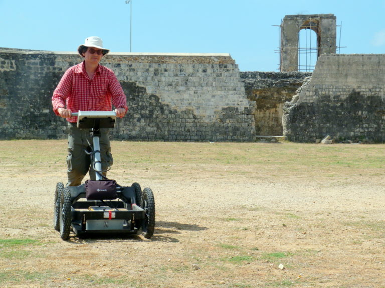
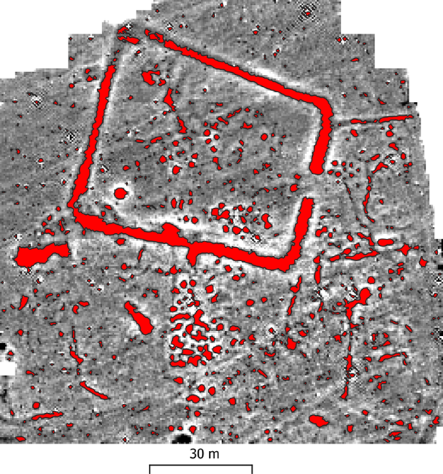
Geophysical Surveys
GeodataWIZ can conduct geophysical surveys to collect data about subsurface structures in a particular area. This might involve using techniques such as magnetometer or earth resistance surveys, or ground-penetrating radar investigations to identify buried features or anomalies that could be of archaeological interest. Using prior magnetic susceptibility measurements helps to evaluate the potential of magnetometer surveys. Having worked extensively in this field, Dr Armin Schmidt has gained a deep understanding of how to achieve successful outcomes, even under difficult conditions. Paramount is the holistic approch that starts with detailed discussions with the client, desiging appropriate survey strategies, careful data collection, processing, analysis and interpretation and ending with the delivery of a detailed report and GIS-ready vector and raster data.
Overall, GeodataWIZ provides a range of services that can help clients in the archaeological and near-surface fields to understand better the geospatial data related to their projects.